
$700.00
Description
-
Aerial Survey Total Project using GCPs
-
Client Portal Link on AD Website / Password Protected
-
Full Access to Download Assets for 30 Days
-
GeoTiff Orthomozaic Image of total Site
-
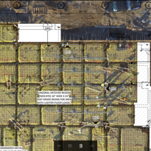
3D Project Model
-
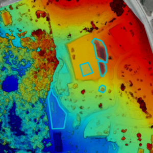
Elevation Map
-
Point Cloud Files Made Available for Engineer to Download
-
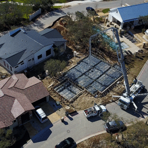
25 High Definition Photos of Project
-
3 Minute 4K High Definition Video of Project
-
Focus on Specific Areas of Interest at Clients Request
-
Schedule to Film Milestone Completions in Progress
-
Create Way-points to Film Exact same Footage Over Time
-
24 hr Turnaround